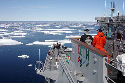
The changing shape of the Arctic has caused the U.S. Navy to step up efforts to strengthen its strategic posture in the region and prepare an increasingly Arctic-capable fleet, service officials said.
The service is finalizing an updated Arctic Road Map aimed at paving the way toward creating the investments, doctrine and technologies needed to ensure the Navy can operate in the rapidly changing Arctic environment.
Rear Adm. Jonathan White, Oceanographer and Navigator of the Navy, explained that the Navy published its first Arctic road map in 2009, but the service has seen enough change in the past four years that it needed an update.
"We've understood the challenge of the Arctic for some time. The Arctic is opening up a little faster than we thought. Instead of the 2030s, we're looking at the mid-2020s as a time when there will be some pretty large open areas in the Arctic," White said in an interview with Military.com. "We're starting to put together a plan regarding what kind of capabilities we will need to put together in coming years to be able to operate up in the Arctic on a much more routine nature."
In the next several decades, new Arctic waterways -- including trade and commercial shipping routes -- will open up during summer months in areas that are now frozen, bringing varying opportunities and challenges.
Chief of Naval Operations Adm. Jonathan Greenert wrote a piece for the Navy's official blog on Nov. 1 explaining his concern with the changes in the Arctic and the Navy's need to update its strategic outlook.
"The inevitable opening of the Arctic will create a new coast on America's north. This opening will present new challenges and opportunities that mandate change in our national policies and strategy," Greenert wrote.
Defense Secretary Chuck Hagel said last week that the Arctic could prove to be one of the most important future regions for national security over the next decades as these changes occur. The attraction for nations and commercial industry includes the pursuit of oil, mineral deposits, fishing, rare earth minerals and liquid natural gas.
The largest existing Arctic shipping route, called the Northern Sea Route, largely parallels the Russian border with the Arctic. This route has seen a large increase in traffic in recent years, officials said.
Russia operates numerous large icebreakers designed to escort commercial vessels through ice patches by breaking up and separating the ice. Ships wishing to pass through the Northern Sea Route are charged a fee by the Russians for safe passage. By comparison, the U.S. Coast Guard operates only a few icebreakers, officials said.
Although U.S. officials do not talk about an Arctic presence in terms of a competition with Russia, they do acknowledge the importance of having a presence there in light of opening waterways and increased traffic in the region. Also, the U.S. has more than 1,000 miles of Arctic coastline bordering Alaska, Navy officials said.
When asked about potential competition or strategic rivalry between the U.S. and Russia regarding the Arctic, White said he hoped the Navy would continue to forge a partnership with its Russian counterparts.
The Navy's 2009 Arctic Road Map includes mission analysis and "fleet readiness" details for the Arctic environment, including search and rescue, maritime security, C4ISR, cooperation with the U.S. Coast Guard, strategic sealift and strategic deterrence, among other things.
"The Arctic is warming twice as fast as the rest of the globe. While significant uncertainty exists in projections for Arctic ice extent, the current scientific consensus indicates the Arctic may experience nearly ice free summers sometime in the 2030s," the 2009 Arctic Road Map states.
An assessment done by the Navy's Task Force Climate Change determined that the rate of melting has increased since the time of this report.
Although the thinning of the Arctic ice was reported by Navy submarines in the 1990s, there have been considerable changes to the Arctic environment since that time, said Robert Freeman, spokesman for the oceanographer of the Navy.
"In 2012, the Arctic saw its minimum amount of ice in history. The 2012 summer ice melt reduced the Arctic ice to about 45 percent of what the average ice has been from 1979 to 2000; 1979 was the first time we had satellites over the Arctic that could record what the ice was doing," Freeman said.
The amount of ice that melts every summer and then re-freezes in the winter is one of several key nuances to this equation, Freeman explained. Perennial ice, or Arctic ice that does not melt away in the summer, is getting much smaller as well.
"There's another metric that is not as easy to get and that is ice thickness. In the old days, the majority of ice was perennial or multi-year ice locked in place that did not melt in summer. The amount of perennial ice has decreased dramatically because of warmer waters in the Arctic," Freeman explained.
Getting ready for possible Arctic missions is not without a wide range of challenges, White and Freeman explained. There is not as much bandwidth, apparatus or infrastructure to support communications networks in the Arctic -- and there are very few ports and bases for logistical support.
Furthermore, the Arctic temperatures, ice, snow, fog and wind create precarious conditions for ships to operate in. Disaster response is much less reliable, and ice can cause problems for sensors, weapons and other equipment.
All of these factors -- coupled with the fact that there has historically been very little activity in the Arctic -- contribute to the reasons why the Navy surface ships have not operated there much, if at all, in recent years.


